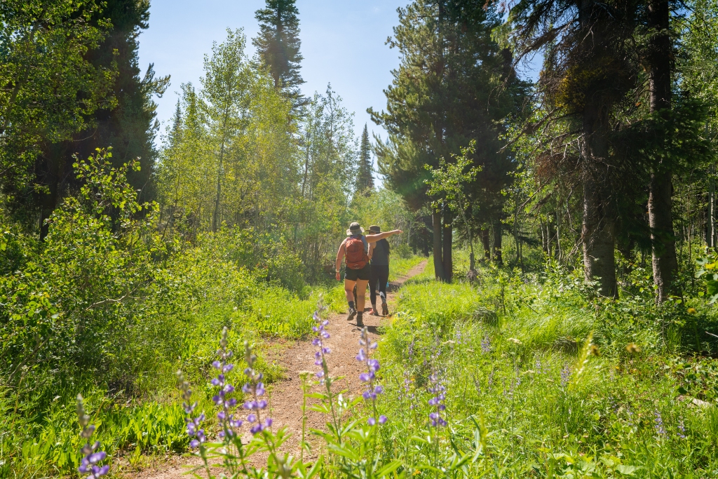
Hikes in Twin Falls range from 5 minutes to a short road trip away. My top 10 favorite hikes near Twin Falls, Idaho are Canyon Rim, Eagle Loop, Box Canyon, Mogensen Trail, Little City of Rocks, Mermaid Cove, Independence Lakes, Auger Falls, Balanced Rock, and finally (my favorite) Skillern Hot Springs.
Ready to get all the photography you possibly can? Here is how I hook my camera to my pack for easy access: https://amzn.to/3PrT79r
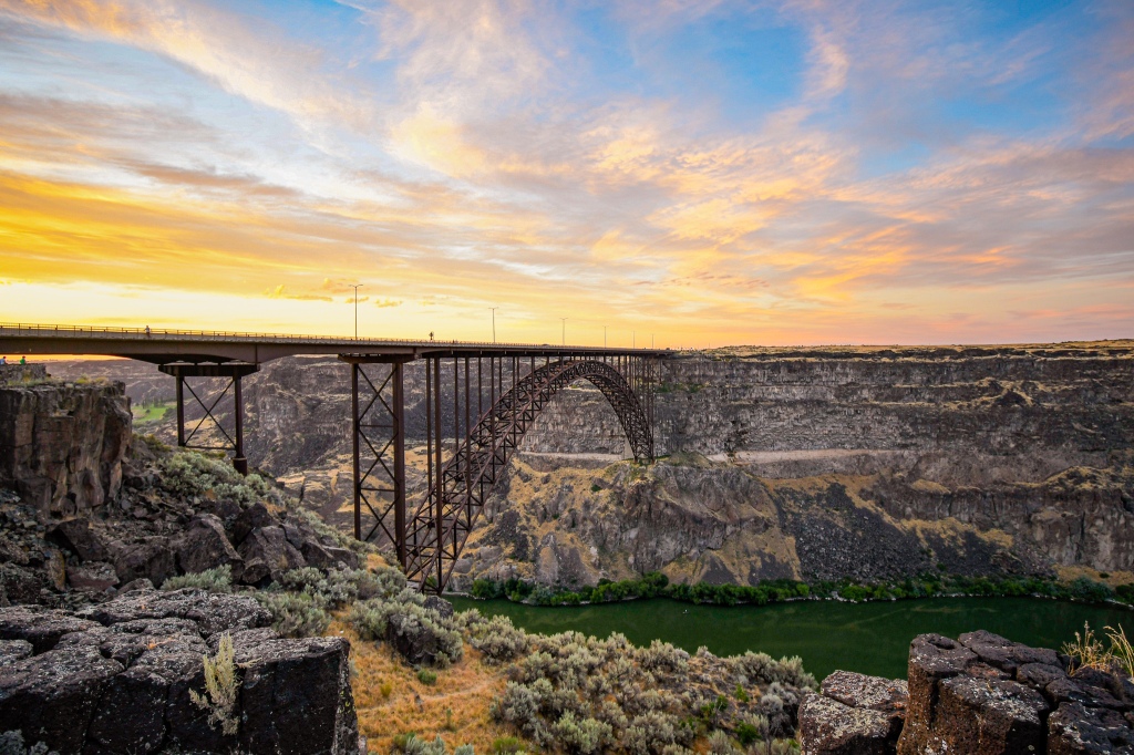
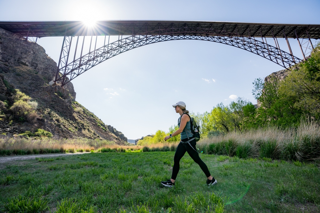
The Canyon Rim Trail
- Spans 8 Miles along the Snake River Canyon in Twin Falls
- Paved Trail (wheel chair accessible, bike, scooter, roller blades, skate board etc allowed)
- Garbages along the trail
- 3 Restroom Options
- Passes Perrine Coulee, Perrine Bridge, Evel Knievel’s jump site, Shoshone Falls
- Parking lot options: Washington Street North, TF Visitor Center, Poleline/Eastland Corner, Shoshone Falls
- Leave no trace. No excuses there are garbage cans and dog bags.
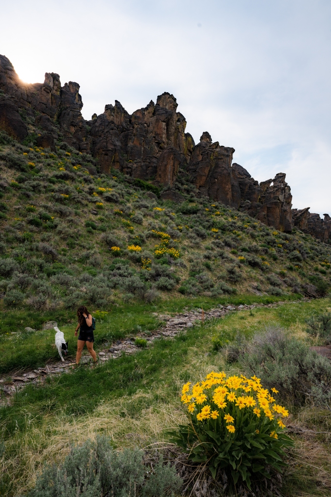
Eagle Loop
- 3 mile loop
- Located 1 hour south of Twin Falls in the South Hills
- Park at Petite Campground near Magic Mountain
- Wildflowers in July
- Not accessible November-May due to snow
- Watch for Moose!
- Leave no trace
Do you need a UV protective hiking shirt? Here is one I absolutely love: https://amzn.to/3PHP5uV
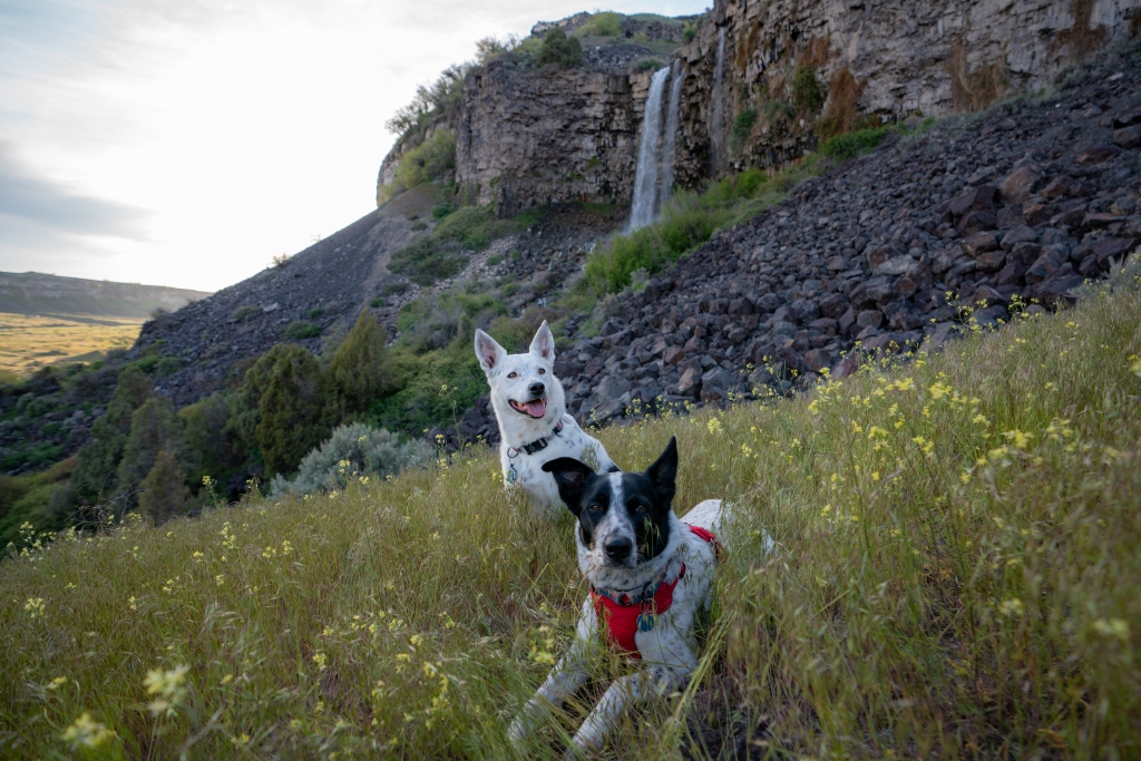
Box Canyon
- 3 miles round trip
- Loop option (goes almost to Snake River) or in and out
- 300 foot elevation gain
- Sturdy Shoes needed for lava rock & uneven trail
- Bring water it gets hot
- Bring a swim suit to take a dip in the freezing water
- Passes a 30 foot waterfall
- Box Canyon State Park lot costs $7 or an ID State Parks Pass
- Leave no trace. This is a State Park and needs to be treated with the utmost respect!
Mogensen Trail
- 3 miles in and out
- Park on the corner before Centennial Waterfront Park
- Some incline and stairs
- Be mindful of poison ivy along the trail
- Walks you under the Perrine Bridge where you can see BASE jumpers
- Leave no trace!
Some awesome hiking boots by Merrell I love: https://amzn.to/46EmOvh
Little City of Rocks
- North of Gooding Idaho
- 7 mile trail plus little breakoff trails
- Wilderness area so not much foot traffic
- Parking lot is off the west side of highway 46
- Leave no trace & please pick up trash if you see any
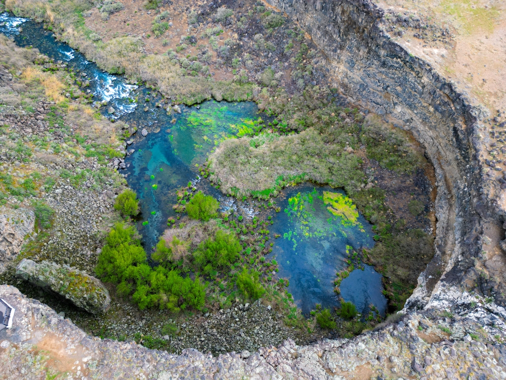
Mermaid Cove
- Jerome side of the Snake River Canyon on Yingst Grade
- Waterfall Cove near parking lot, then big waterfall down the canyon
- 2 mile round trip
- 480 foot elevation gain
- Bring water!
- Do not swim here*
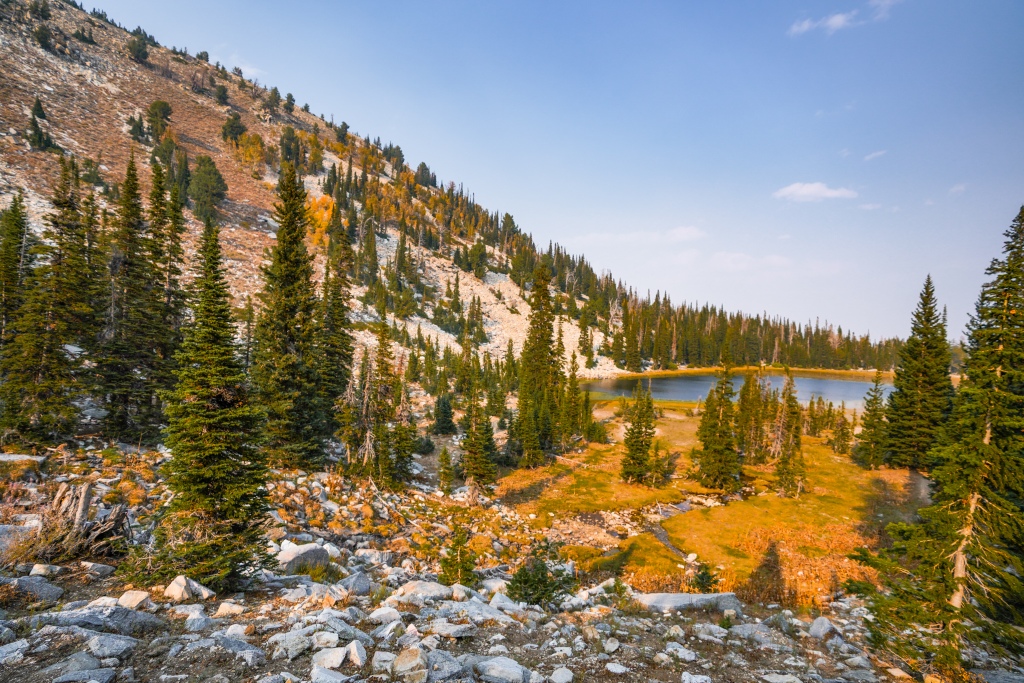
Independence Lakes
- 7 miles round trip (to arrive at 3rd lake)
- 1,600 elevation gain
- Bring snacks and water
- Stunning views!
- Long drive (2 hours from Twin Falls)
- Camping available
- Only accessible July-September
- Leave no trace
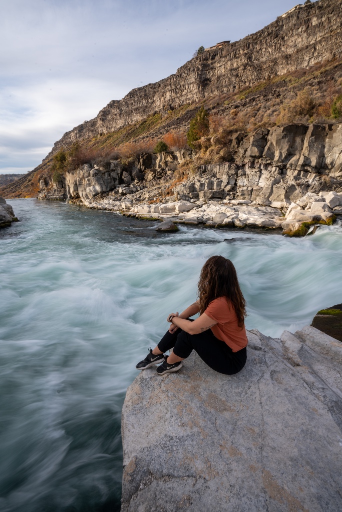
Auger Falls
- 4 Miles round trip
- Auger Falls Heritage Park parking lot
- Watch for snakes in the summer
- Do not swim here*
- Share the trails with bikers!
- 1 mile into the trail branch north to be next to the powerful riverside waterfall
- Leave no trace
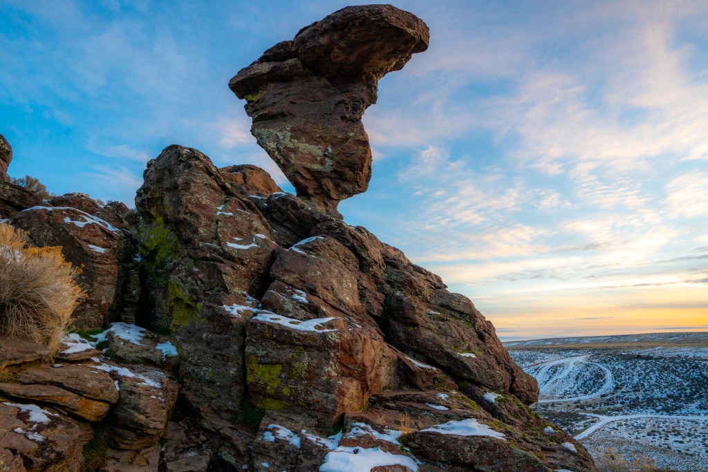
Balanced Rock
- 1 mile round trip
- 200 foot elevation gain, then walking above the rock formations
- Leave no trace
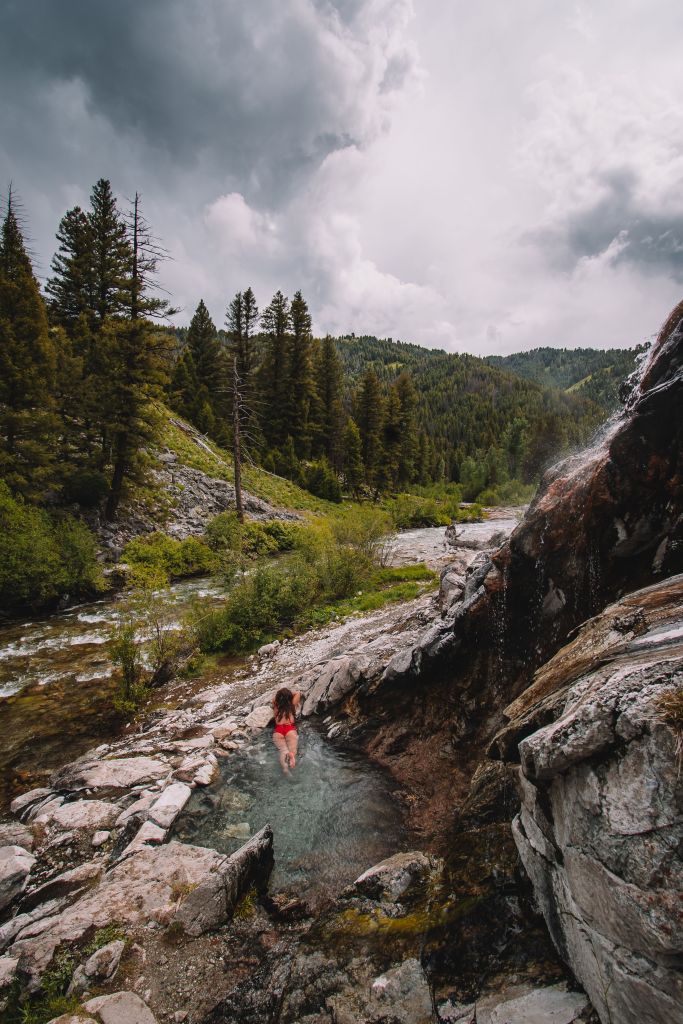
Skillern Hot Springs
- 6 Miles round trip
- Pack lots of water & sturdy shoes
- 700 foot elevation gain (high trail)
- 2 deep river crossings (low trail only)
- Leads to hot springs!
- PLEASE leave no trace & be respectful to all those outdoors