Take on a bucket-list Idaho hiking challenge: The Grand Slams north of Boise, Idaho
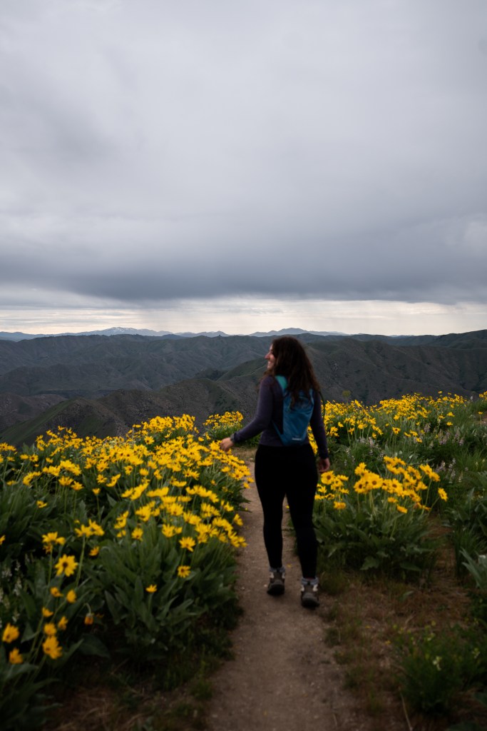
Are you ready to tackle the Grand Slam Peaks in Boise? There are four peaks in Boise National Forest near Lucky Peak State Park that are fun but challenging. They show off incredible wildflowers every spring and provide bragging rights when you complete them all. These are STEEP hikes for an average hiker. Make sure you’re in hiking shape before hitting the hills. I’ll get into how to hike these trails, what I would do to prepare for them, and details on how far they are and elevation gain.
I have personally hiked all 4/4 Grand Slams! This is the order I would recommend doing them so you can build up to the tough ones! If you’re an advanced hiker – do them however you’d like! I also know some people who hike multiple in a day. (I did not do this order, I actually started with Heinen, but that was mostly because I was training for a long & steep 14er!)
- Cervidae Peak: 4.4 miles, 1,883 elevation gain.
- Kepros Mountain: 9.4 miles, 1,988 elevation gain.
- Shaw or Lucky Peak: 10.4 miles, 2,545 elevation gain
- Mount Heinen: 9.5 miles, 3,723 elevation gain.
How to Hike the Grand Slams?
You can do anything you put your mind to! Enjoy hiking these for a challenge and be safe. If you haven’t done much hiking before I highly recommend getting on a stair stepper. That will get your knees ready to go uphill, and start walking/running outside or on the treadmill at an incline to build up even more stamina. I also make sure to do weight training like lunges and squats. Feeling strong and powerful on your hikes will help you successfully summit these peaks, and it is important to be prepared! We don’t want any injuries out here with no service and some trails not as popular as others.
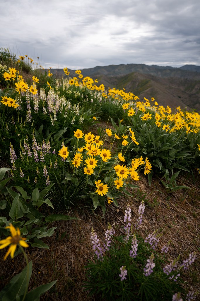
Remember to never leave trash or pick the wildflowers. Be sure to bring loads of water for these hikes and a couple snacks! I ate a whole sandwich on Heinen. These are challenging hikes but so rewarding! Use hiking poles. They will help with knee stability on those steep descents, and also help you get uphill.
My trekking poles (Amazon Link)
Will you be crossing 4/4 grand slams off your list this year? Continue reading for hike specific details!
Hike Details and tips to summit
Here is my Camera Set Up on Amazon Too!
Cervidae Peak:
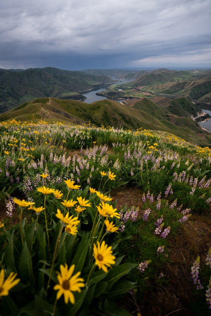
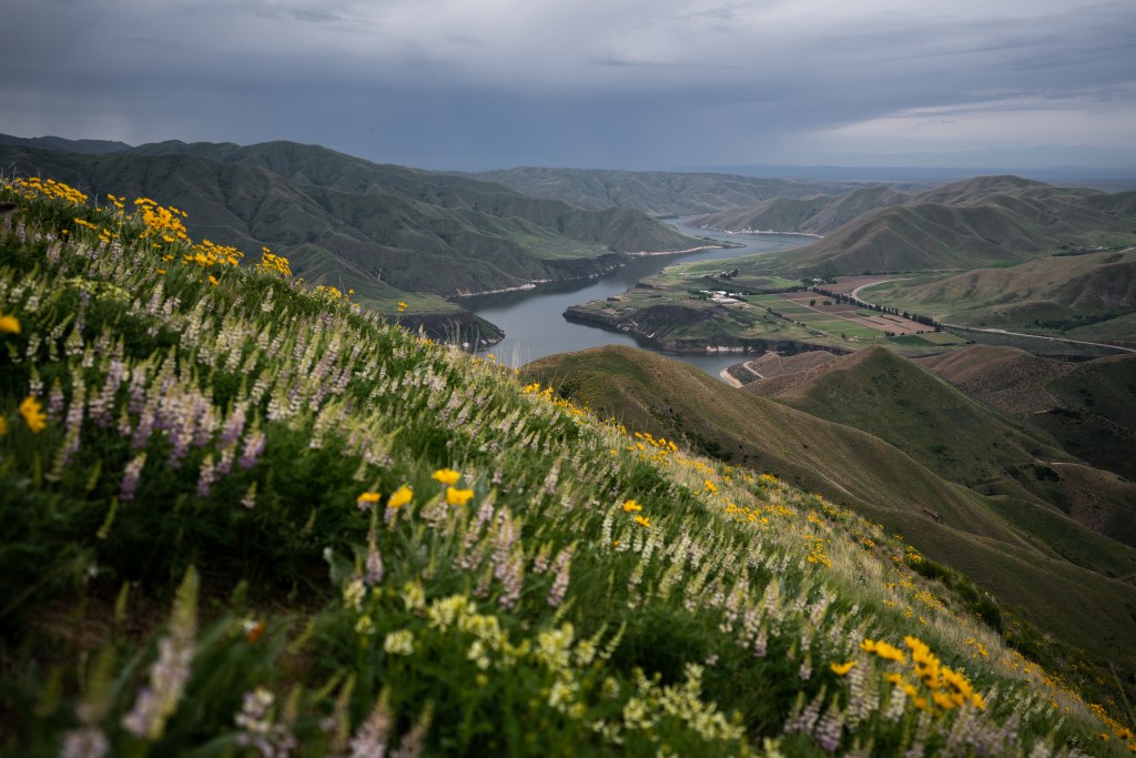
4.4 miles, 1,883 elevation gain. The wildflowers begin to bloom early May and the arrowroot is usually there almost all of May! The Lupine come usually end of May and into June. This is one of the most popular trails near Boise. You have to show up early to fit in the parking lot. It’s a good thing though, because you don’t want to hike Cervidae late in the day because it gets hot.
Affiliate Airbnb Link to Stay Nearby (Very Cute)
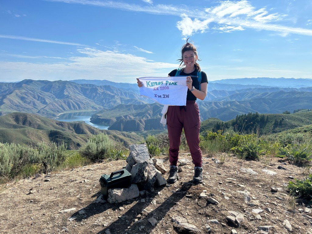
Kepros Mountain:
9.4 miles, 1,988 elevation gain. Be sure to download a trail to your phone to navigate! I used AllTrails and it kept me on the right path. There are a couple different options to hike this, and I recommend always staying low when possible. There are some trees on this hike, but not many. Begin early to prepare for the heat. The views on Kepros is really amazing! It is somewhat unique to the rest of these due to the trees. This hike is just long, not too steep – so to prepare make sure you’re on your feet for a few hours and get some 10,000+ step days in often leading up to it.
Affiliate Airbnb Link to a really gorgeous stay near Boise that’s in the Foothills
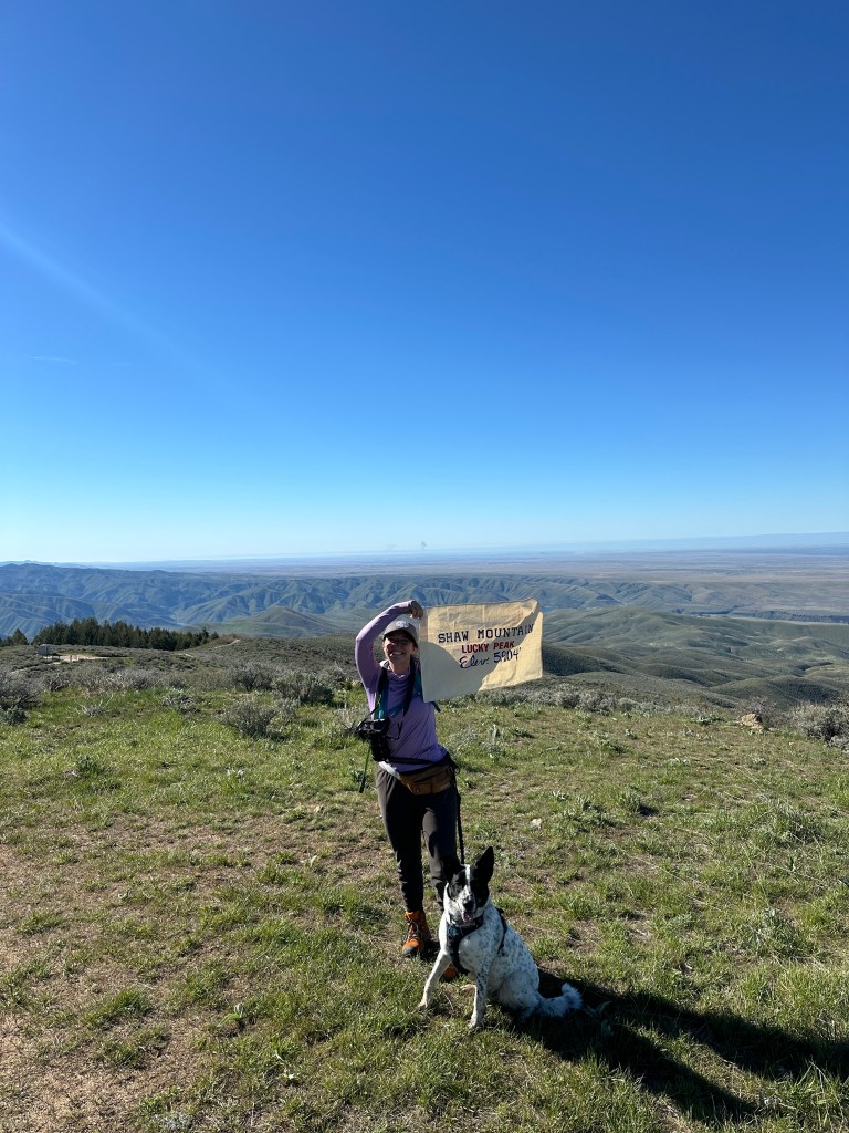
Shaw Mountain:
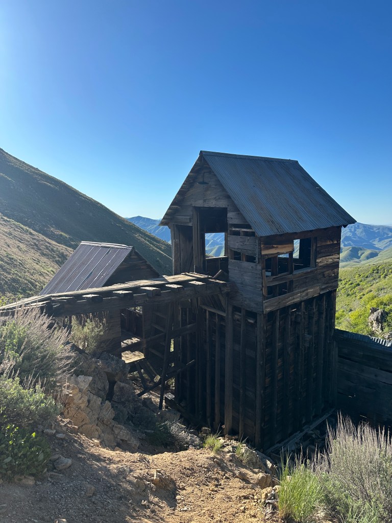
Shaw Mountain otherwise known as Lucky Peak: there are actually two ways to do this trail! You can take the trail only leading to Shaw which is 10.4 miles and 2,545 elevation gain, or the way I did it by hiking to Adelmann Mine first. Then follow the connecting trail to continue onto Lucky Peak. This will cut your hike in half and keep the elevation gain down. It was somewhat difficult to know exactly where to go, and we had to bushwhack a bit. As you can see I had my dog with me! All of these trails are dog friendly, but there is no water so make sure to pack extra for your furry friends! Dogs must be on leash from April 30th-October.
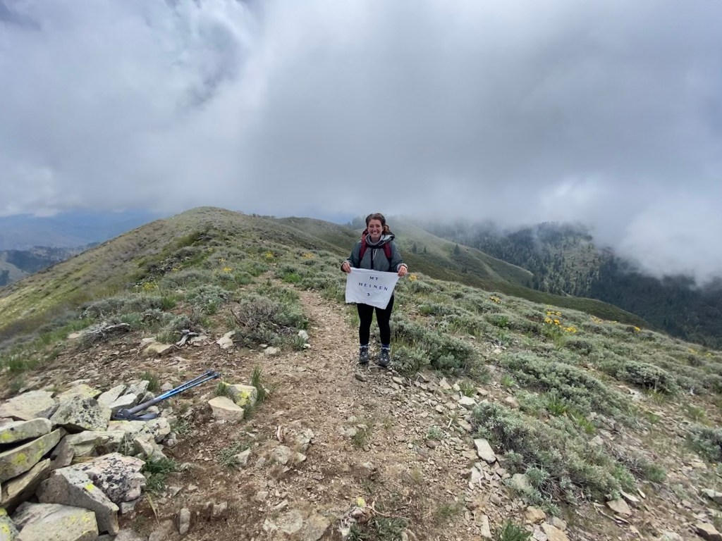
Mount Heinen:
Mount Heinen: 9.5 miles, 3,723 elevation gain. This one is steep and tough. Bring trekking poles and take it one step at a time. The first 2 miles (and then last 2 miles) are the worst. The first 2 miles are straight up and will push you. The last 2 down are so steep your knees will feel it. Drink electrolyte water and eat snacks. You will need the calories! Take this one as slow as you need & be kind to yourself. Trust me, I had the thought in my head of “why am I doing this?” Pushing through will make you stronger! Heinen has some gorgeous views and some trees along the way too.
Airbnb near the Airport (Affiliate Link!)
Let me know if you have any questions about hiking the Grand Slams near Boise, Idaho! Find me on Instagram @earthtosarahphoto or TikTok @earthtosarah
